On a sloping Porirua site, even a well-planned cut can move in ways the borehole log didn't predict. The hills behind Whitireia Park or the weathered greywacke benches near Aotea Block don't read the lab report—they respond to rain, vibration and unloading in real time. That is where systematic monitoring changes the risk profile of the job. We track lateral displacement, vibration velocity and pore-water pressure during bulk excavation, providing the data that lets contractors and designers adjust support sequences before a crack appears in the neighbouring lot. In a city built across ridgelines and reclaimed stream valleys, monitoring isn't a compliance checkbox—it is the difference between a controlled dig and an expensive repair. When the trench reaches weathered rock, combining monitoring with deep excavation analysis clarifies whether the temporary batter is holding or needs immediate reinforcement.
Monitoring turns an assumption about ground behaviour into a measured fact—and in Porirua’s mixed colluvium and greywacke, assumptions cost money.
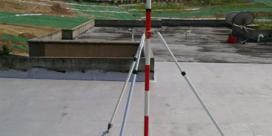
Methodology and scope
Local considerations
Porirua’s weather swings hard: a dry southerly can give way to a week of orographic rain as westerlies hit the hills behind Tītahi Bay, saturating the soil mantle quickly. An excavation that stood firm on Tuesday can start slumping by Friday morning. Our monitoring program catches that shift early, correlating rainfall data from the site weather station with real-time inclinometer and piezometer readings. The real danger isn't the big collapse you see coming—it’s the slow, undetected relaxation of a cut face that destabilises a neighbouring footing. In the harbour-edge suburbs, where groundwater sits high and responds to tide cycles, we add electrical resistivity probes to track salinity changes that can accelerate corrosion of temporary steel supports, a detail often overlooked in generic monitoring plans.
Applicable standards
NZS 3404:1997 Steel Structures (vibration limits for adjacent structures), NZS 4203:1992 General Structural Design (seismic loadings), NZGS Field Description of Soil and Rock Guideline (2005), AS 1726:2017 Geotechnical Site Investigations (instrumentation section), WorkSafe NZ Excavation Safety Guidelines (Good Practice Guide)
Associated technical services
Vibration & Noise Monitoring
Triaxial geophones at property boundaries, with SMS alerts when peak particle velocity approaches 80% of the consented limit. We correlate blast or hammer events with structural response on adjacent buildings.
Deformation & Inclinometer Arrays
Vertical inclinometer casings installed behind the cut face, read daily or continuously. Combined with surface settlement points, we map the deformation bowl in three dimensions.
Groundwater & Pore-Pressure Tracking
Standpipe and vibrating-wire piezometers logged automatically, with rainfall data overlay. Essential for cuts below the water table in the Porirua basin and harbour-fringe fills.
Typical parameters
Frequently asked questions
When is continuous monitoring required versus weekly manual readings?
Continuous automated monitoring is warranted when the excavation depth exceeds 4 m in soft ground, when the cut is within 1.5 times its depth of an occupied structure, or when vibration-intensive methods like rock hammering are used. Weekly manual surveys may suffice for shallow trenches in competent greywacke where no adjacent buildings exist. The final decision is risk-based and aligned with the NZGS guideline on field investigation.
What are the typical vibration trigger levels for Porirua residential areas?
We typically set alert thresholds at 5 mm/s PPV for heritage or brittle structures (pre-1950s timber on shallow footings) and 10–15 mm/s for modern residential slabs, referencing the DIN 4150-3 guideline. These values are conservative and are always reviewed with the project structural engineer against the specific building condition survey.
How much does a typical excavation monitoring program cost?
Monitoring programs in Porirua generally range from NZ$1,380 for a short-term, single-parameter setup on a small residential cut up to NZ$4,120 for a multi-instrument array with automated logging and daily reporting over a 4–6 week excavation window. Each quotation is scoped after a site walkover and review of the excavation design.
Can you monitor behind an existing retaining wall during an adjacent excavation?
Yes. We install inclinometer casings and survey prisms on the wall itself and in the retained ground behind it. This captures both wall deflection and global slope movement, allowing the contractor to adjust the dig sequence if the wall shows unexpected drift.
What happens if a monitoring instrument fails during the dig?
We keep a backup set of portable instruments in the Wellington region and can replace a failed sensor within 24 hours. The dataset is gap-labelled in the daily report, and the engineer is notified immediately so they can decide whether to pause work near that zone until the reading chain is restored.