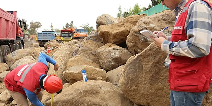
You see a lot of split-spoon samplers and thin-walled Shelby tubes on Porirua job sites, especially near the Pauatahanui Inlet where the sedimentary profile can change within a few meters. A soil mechanics study starts with that tactile, hands-on phase: extracting undisturbed samples, logging the fines content by feel, and packing cores into wax-lined sleeves before they dry out in the coastal wind. The lab work that follows—triaxial compression, incremental oedometer loading, Atterberg limits—translates those field observations into parameters a structural engineer can actually use. In a city where greywacke bedrock can sit just below compressible Holocene silts, skipping the physical sampling often leads to assumptions that don’t survive the first excavation.
A plasticity index above 18 in Porirua’s residual clays signals a soil that will soften significantly with any water ingress during construction.
Methodology and scope
Local considerations
A six-storey apartment block was going up along the Kenepuru Drive corridor, designed on the assumption of a stiff clay bearing stratum at 2.5 meters depth based on a single borehole. During bulk excavation, the contractor hit a lens of saturated, normally consolidated silt that had never been drained since the last marine transgression. The base heaved, the adjacent footpath settled by 80 millimeters, and the project lost four months while a revised foundation scheme was engineered. That scenario has played out in various forms from Cannons Creek to Pukerua Bay, and it always traces back to an incomplete geotechnical model. A thorough soil mechanics study would have identified the pore pressure regime and the true preconsolidation stress before the first pile was driven, saving both time and the cost of emergency slope stabilization.
Applicable standards
NZS 4402: Methods of Testing Soils for Civil Engineering Purposes, NZS 1170.5: Structural Design Actions – Earthquake Actions, NZGS Guideline for Field Classification and Description of Soil and Rock, NZS 3404: Steel Structures (for soil-structure interaction)
Associated technical services
Strength and Consolidation Testing
Consolidated-undrained and drained triaxial tests on 50mm or 70mm specimens, plus incremental oedometer consolidation to establish the preconsolidation pressure and settlement timeline for foundation design.
Index and Chemical Characterization
Full Atterberg limits, particle size distribution by sieve and hydrometer, and soil aggressivity screening (pH, resistivity, sulfate/chloride content) to assess corrosion potential for buried concrete and steel, particularly in reclaimed areas around the Porirua Stream mouth.
Earthquake-Relevant Dynamic Properties
Cyclic triaxial and resonant column tests to determine shear modulus degradation and damping ratio curves, feeding directly into site-specific response analysis for compliance with NZS 1170.5 spectral shape requirements.
Typical parameters
Frequently asked questions
What does a soil mechanics study cost for a typical single-lot residential build in Porirua?
For a standard site investigation involving one or two machine-dug test pits, logging, and a targeted lab program (Atterbergs, particle size distribution, and a shear strength suite), the fee generally ranges from NZ$5,880 to NZ$7,760. The final figure depends on access constraints, the depth of the bearing stratum, and whether undisturbed Shelby tube sampling is required.
How long does the laboratory testing phase take once the samples are collected?
Consolidation tests inherently run for several days to a week to capture the primary compression curve, while triaxial shear stages can complete within one to two weeks depending on the drainage conditions. A typical residential program is reported within three to four weeks, though large commercial projects with multiple oedometer and cyclic triaxial suites may extend the timeline.
Do you test for liquefaction susceptibility as part of the soil mechanics study?
Yes, where the subsurface profile includes saturated sands or low-plasticity silts below the water table. We run fines content and plasticity analyses to screen for liquefiable behavior per the NZGS Module 4 guidelines, and can pair the soil mechanics data with a CPT test to obtain a continuous pore pressure and tip resistance profile for a full Boulanger-Idriss triggering analysis.
Which Porirua suburbs have the most challenging ground conditions for foundations?
The coastal margin from Onepoto to Paremata often presents highly compressible estuarine sediments with organic layers, while the hillside subdivisions in Whitby and Aotea sit on weathered greywacke with variable depth to rock and residual clay mantles that can creep on steep slopes. Each area requires a different geotechnical approach, and our lab program is tailored to the specific material behavior we encounter in the borehole or test pit.